

The compass, known as Sinan in ancient times, is one of the four great inventions of ancient China. Its main component is a magnetic needle mounted on a shaft.
Magnetic needle in the role of the natural geomagnetic field can freely rotate and remain in the direction of the tangent to the magnetic meridian, the south pole of the magnetic needle points to the geographic south pole (magnetic field north pole), the use of this performance can identify the direction.
In modern society, there are many roles for the compass.
Four stages of compass development.
1. Sinan
As early as two thousand years ago Han (206 BC - 220 AD), skilled craftsmen polished and chiselled the magnet into a spoon shape, placed it on a smooth mirror-like chassis made of bronze, and then cast it on the directional engraving when this magnetic spoon stopped rotating on the chassis.
The direction of the spoon handle was due south, and the direction of the spoon mouth was due north, which was the earliest directional instrument in the world invented by our ancestors, called Sinan.
2. Ancient compass
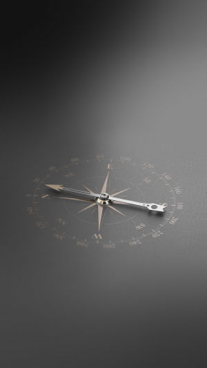
Later, the ancients made the ancient compass based on Sinan. At this time, the compass was very much like the compass used now, it has a magnetic needle to point the direction and a scale to show the direction. Put a compass on the ship, which can guide the direction of people sailing.
3. Guide fish
Around the early years of the Northern Song Dynasty, due to the needs of military and navigation and the development of materials and technology, the use of artificial magnets and magnet needles and artificial magnetization methods have been made in the performance and use of the guide fish more advanced than the Sinan.
4. Compass
Soon after the invention of the compass fish, a more significant, simpler, easier to use, and more widely used compass was invented. The compass used natural magnets to grind iron needles, and the ground iron needles could point south.
It is also noted that the compass does not guide perfectly, but is slightly east. This is the phenomenon of magnetic declination.
How to use the compass
1. Let's take out the compass.
2. Then make the magnetic needle inside the compass and the bottom of the straight line overlap.
3. Generally speaking, the better quality compass has two colors, and the color of the magnetic needle is the same as the color of the straight line at the bottom, which is the north.
For example, if the color of the magnetic needle is half red and half black, and the straight line at the bottom is red, stack the magnetic needle on the straight line, because the bottom is red, and the red part of the magnetic needle points to the north.
Compass can be applied to geodesy, in modern society, the compass is not only used for navigation but also widely used in land mapping, area measurement, and other aspects of work, the use of the compass, you can make a map and the actual terrain of the same orientation.
The compass can be used to measure altitude. Measuring altitude requires professional electronic instruments, but the compass in a typical cell phone can also measure altitude. Just turn on the phone's built-in compass and it will display the local altitude and other data.
The compass can also be used to measure latitude and longitude. Some electronic compasses, in addition to displaying the direction data, can also directly display the local latitude and longitude.
But the traditional compass can not directly see the latitude and longitude, you need to determine the compass according to the direction and then calculate the latitude and longitude.